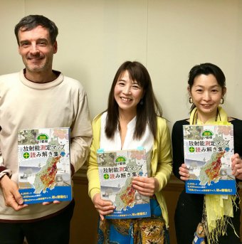
How to buy our map book
Instruction how to buy out map book
Buy via Paypal
Please send information below:
Your Name:
Shipping Address:
Country:
Quantity of English edition:
Quantity of Japanese edition:
Contact(mail address):
We will let you know our Paypal ID and the price including shipping fee.
Note: the Price of English edition is 500yen/each copy
the Price of Japanese edition is 2,500yen/each copy
Click here to send the information to open the contact form
or send a mail to minnanods@gmail.com.
Buy via Amazon co.jp
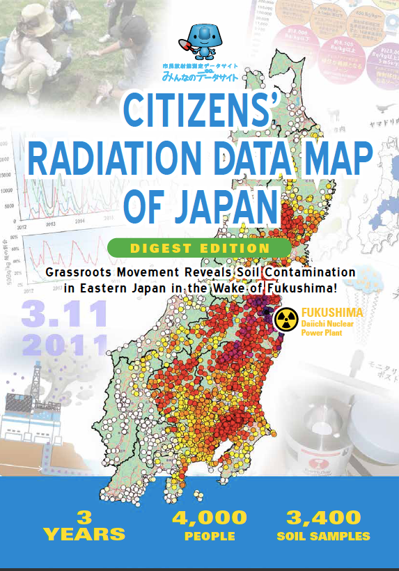
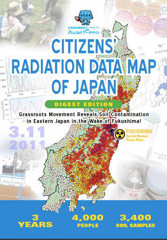
You can buy both the English and Japanese edition via amazon.co.jp.
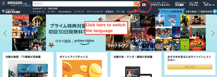
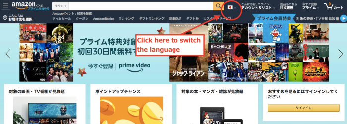
To switch languages to your language on Amazon pages, please click the flag mark which locates on the right side of search bar- indicated below with red circle.
Amazon global shipping services covers 67 country.
Japanese edition
Containing 200pages. Color. Price is 2,315yen + tax + shipping
English edition
Containing 16pages. Color. Price is 500yen + tax + shipping
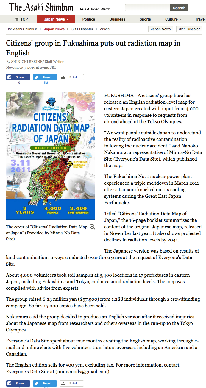
The Asahi Shinbun Web- English Map book was introduced
Our English edition book has been introduced online Asahi News Paper.
http://www.asahi.com/ajw/articles/AJ201911030001.html
How to get
Buy via Paypal
Please send information below:
Your Name:
Shipping Address:
Country:
Quantity of English edition:
Quantity of Japanese edition:
Contact(mail address):
We will let you know our Paypal ID and the price including shipping fee.
Click here to send the information
Buy via Amazon co. jp
To get this booklet:
You can buy both the English and Japanese edition via amazon.co.jp.
Japanese edition
Containing 200pages. Color. Price is 2,315yen + tax + shipping
English edition
Containing 16pages. Color. Price is 500yen + tax + shipping
To switch languages to your language on Amazon pages, please click the flag mark which locates on the right side of search bar- indicated below with red circle.
Amazon global shipping services covers 67 country.
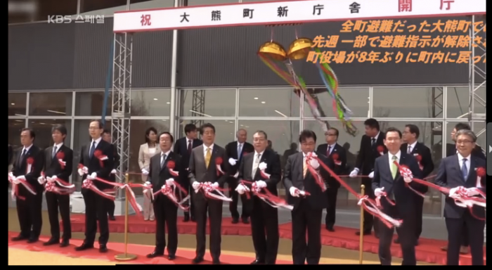
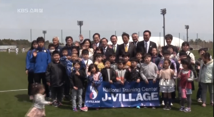
[TV] Korea KBS TV coverage feature (5/9)
Korean KBS TV "KBS Special" broadcasted on May 9, 2019 featured the situation of Japan and Korea surrounding Fukushima Daiichi Nuclear Power Plant accident.
It introduced the movement of the Japanese government after the accident, the movement in Korea, and various citizen activities in Japan.
As one of the civic activities,
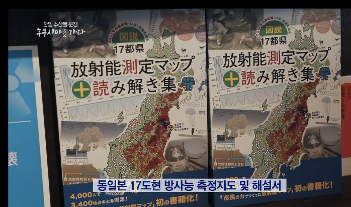
The “Fukushima 30-Year Project”, which measures with the hotspot finder, and “Illustration 17 Metropolitan Radioactivity Measurement Map + Readings Collection” on the data site of everyone were also introduced.
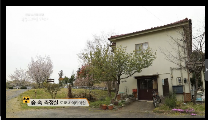
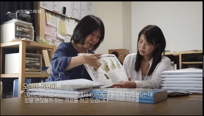
The coverage area was the measurement room Yukikawa in the forest of Saitama Prefecture.
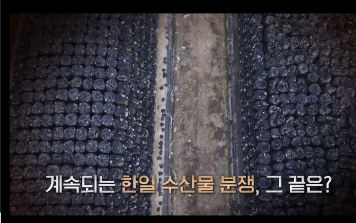
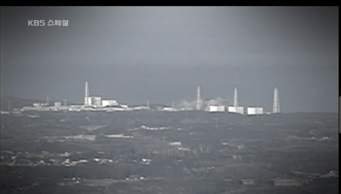
It is difficult to publish videos as it is because of copyright, so we will tell the atmosphere with a captured image, though it is a small part of the one-hour program.
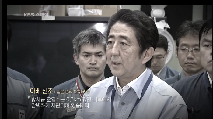
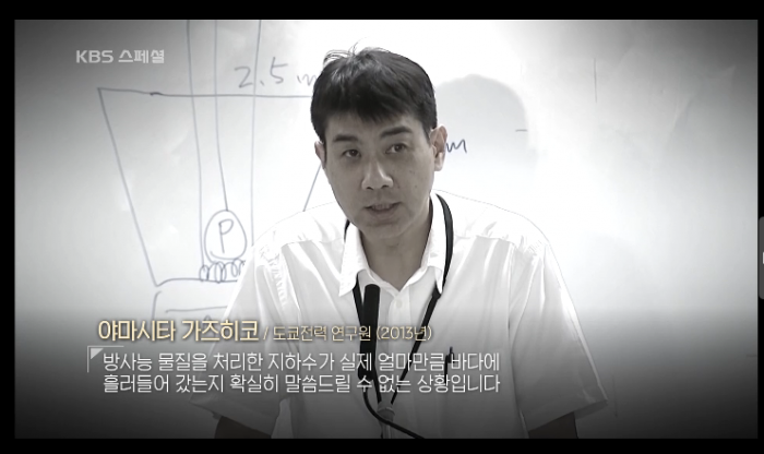
It is understood that the accident that the contaminated water leaked to the sea in 2013 is a serious problem internationally.
Contaminated water was not contained.
I can not explain to me how much contaminated water leaked into the sea (picture below)
Demonstrations of imported food from Japan in Korea were also shown.
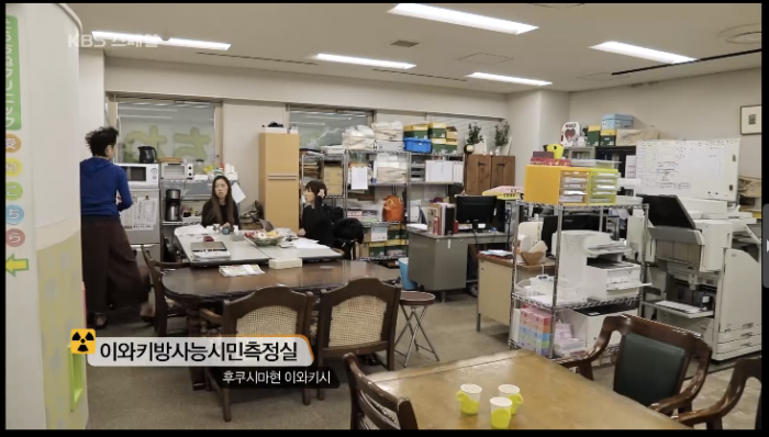
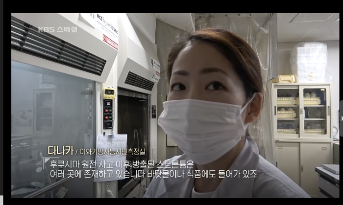
As a citizen's measuring station that can also measure strontium,
"Tarachine" was introduced.
It also shows how to measure fish and so on. (The two photos below are Tarachisan)
On the other hand, although the photograph is not put here, a large institution equipped with 11 germanium semiconductor detectors was interviewed by the governmental agency.
It was also shown that the people there had little knowledge about strontium.
He explained that it was calculated from the ratio of emissions, and that the government conducted surveys using cesium as a representative nuclide.
It was felt that the Korean side's eyes were quite suitable for marine pollution.
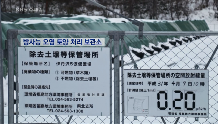
Next is soil.
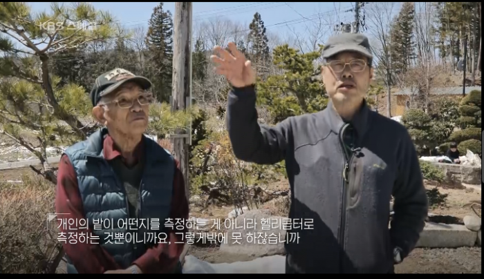
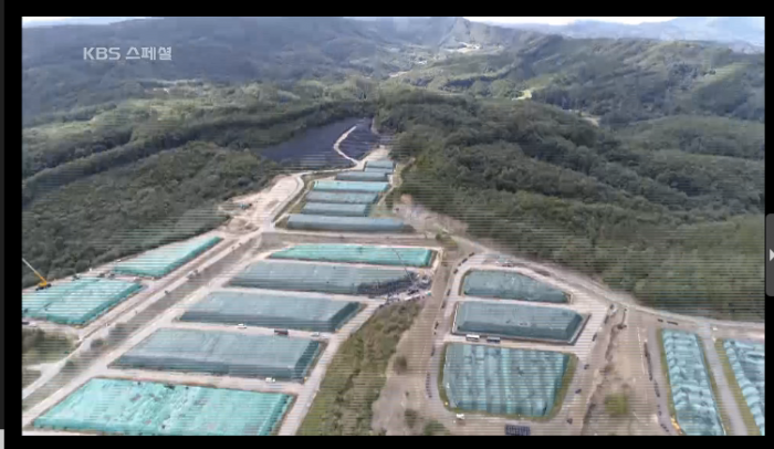
In the picture below, the country measures and averages from the sky, and decides evacuation and cancellation with it. It can not be said whether each field is one. People of Fukushima explaining.
Well, from here is the person concerned with the data site.
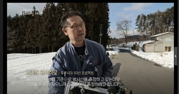
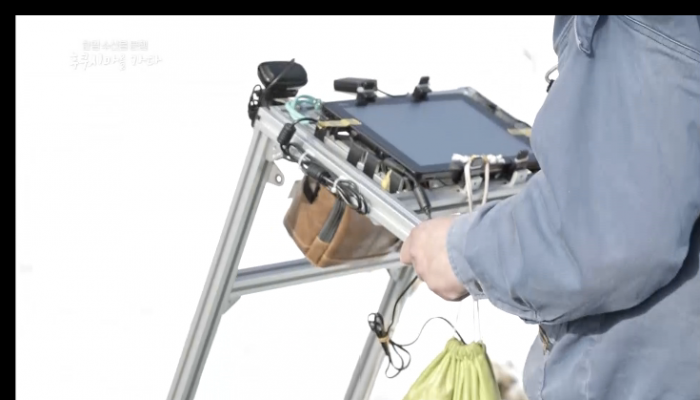
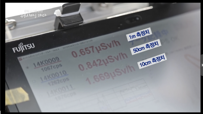
Mr. Shimizu of the Fukushima 30-year project measures simultaneously while walking an air dose of 10 cm, 50 cm, 1 m 3 heights from the ground using a device called a hotspot finder.
Although the national standard is 1 meter above the ground, it is 50 cm to know the effects on short children, and because radiation is on the ground, it is explained that it measures even near ground.
Even in the same place, it can be seen from the video that there is a big difference in numerical values between 1m on the ground and 10cm on the ground.
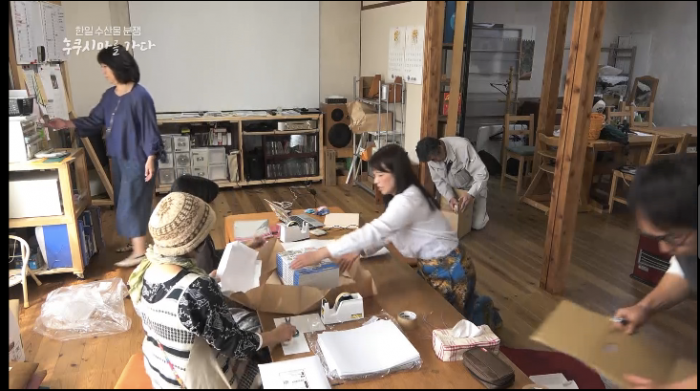
Coverage of data site of all was carried out in one of the participating measurement rooms, "Measuring room Shukawa of the forest" (Saitama prefecture).
It's in a nice place.
The contents of the map collection were introduced along with the state of shipping work of the map collection.
He also introduced me about what you have left at the bookstore.
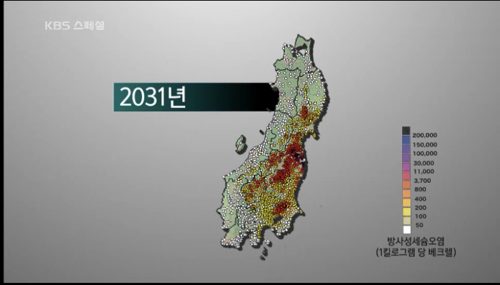
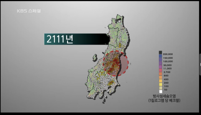
It is explained that radioactive contamination is highly contaminated not only in Fukushima Prefecture, but also when it is actually measured 5 cm deep soil, Kanto including Tokyo is also highly polluted compared with before the nuclear accident.
He also introduced you to the cesium forecast that will decline with the 100-year map.
Although the effects of radioactive contamination are continuing in the nuclear accident,
The appeal of reconstruction by the Japanese government is also intensifying toward the Olympics approaching in 2020.
Such a situation was introduced as a summary in this program.
In this blog, only a part of the content can be introduced.
In this whole program, I spent a lot of time visiting public organizations, citizen groups, lawyers, etc., quite a lot of people and places, and was interviewed carefully.
【Radio】 Arthur Binard "Afternoon Three Drops" On Air!
2019 4/22-4/26 (Fri) Cultural Broadcasting "Kazumi Saito News Wide SAKIDORI!
In this program, our book "illustration · 17 prefectures radioactivity measurement map + reading collection" has introduced through a week.
Nahoko Nakamura of the secretariat talked with Mr. Arthur Binard.
The following is a brief introduction to on air.
"Why is the title of the book not containing the word contamination?"
A book self-published by a citizen group has become a topic,
It has spread over 10,000 copies in 4th edition “Illustration ・ 17 prefectures radioactivity measurement map + reading collection”
The first day is the beginning of the "everyone's data site",
Citizen measurement room which was born by citizen's wish after nuclear accident networked,
We introduced that we came to share measurement result.
And why is the title of the book not saying "contaminated"?
In response to a question from Mr. Arthur, I introduced the process and thoughts.
As to whether the word "contaminated" is included in the title,
We discussed a lot inside.
"Sometimes it's true that there is pollution, so it's better to write it clearly."
But what do you think if people living in the area see the word "pollution"? I thought.
So I can not put it in the title of the book, but from where to where pollution is
I decided to have a person who read this book look at it, and this is a title that conveys that what I measured is on.
In order not to be rejected by the word of pollution, at first it is easy to get it by hand,
It is the result of thinking by everyone.
From Mr. Arthur, it's a cruel word that's tainted. Because it will push everything to the other party.
Actually, we all share this, and we all have to somehow accept it.
But if you don't face it, you will end up not having it, so if you get a rejection response from pollution, you have no body or lid.
And commented.
"Soil project is 100 million total Ino Tadada project!"
Extensive, detailed soil contamination survey after the nuclear accident that the government does not try to do.
Therefore, citizen starts up and starts "East Japan soil becquerel measurement project" to collect and measure soil in depth 5cm in 17 capital prefectures and collect soil more than 3,400 places in three years,
We introduced that we were able to measure and make a map.
From Arthur,
"I think if he had lived in the 21st century, he would have done this.
100 million total Ino Tadashi project! "
The remark saying that jumped out.
Inou Taida had done alone for many decades, but this one wanted to measure before the radioactive material of the half-life of two years of cesium 134 disappears.
Because it is the evidence that it is "the radiation from the Fukushima nuclear accident".
So you can't do it alone for decades, so
We called on many citizens and worked hard with 4,000 people and managed to end in three years.
We introduced that.
"Citizens' data does not lie"
In this project, measurement is done by citizen's measurement room.
Is it not a governmental institution, but can you measure it properly? I proceeded with the story from the point of view.
Citizens face data honestly. Of course there may be mistakes, etc.
In that case, you will notice a mistake because it deviates greatly.
Also, do not know well? If you get a measurement that seems to be
We also introduced the mechanism of "cross-check" where the sample is sent to another measurement room to be re-measured, and it is shown that we guarantee the accuracy of the measurement.
Arthur, on the other hand,
"Professions know how to measure in various ways, and there are techniques that have been accumulated so far ...
You can make it go wrong. The word "".
Also, to what lower value do you want to know,
We also told that the purpose of the measurement is different between the administration and the citizens.
As for the administration, does the sum total value of cesium 134 and cesium 137 which country establishes do not exceed the standard value of 100 Bq / kg? Because I mainly look at
How many becquerles or none? There are a lot of high data of the lower limit which we do not see until the point.
On the other hand, 5 becquerels are not detected when measuring at a citizen's measuring station,
Maybe there is about 3 becquerel? When
If you look at and feel the data under measurement, extend the measurement time and aim for a lower limit value,
We will continue to make measurements to determine the presence or absence of cesium.
We introduced such a measurement stance of citizen's measuring point that "seeks persistent data".
Also, because it is not possible to compare figures without the same collection method,
We introduced that we made unified standard called depth 5cm and thoroughly carried out the same collection method.
"Why did I need to make a map?"
The maps in the collection of maps are not "Sieverts" that show air dose,
In fact, it is a map of "becquerel" unit that shows how much radioactive substance is there.
This idea is modeled on the Atlas called "Atlas" created by governments such as Russia and Belarus after the Chernobyl accident.
Each municipality is measured with Becquerel and Sievert therapy finely.
By calculating the becquerel value, it is a map that shows the existence condition of the radiation until 70 years later by color every 10 years.
Based on these data, we decided to prohibit residents from entering the area, migration and medical support, etc.
This atlas is easy for anyone who sees when they can return to the land.
Even in Japan, after the nuclear accident, the country was originally responsible for carrying out such contamination investigations in a wide range of areas, and based on the measurement results,
I think that evacuation, migration, and compensation to the residents should be done in detail.
However, even after half an year since the accident, it has been a year, but in Fukushima Prefecture, there are only rough estimates such as estimates from measurements by aircraft monitoring.
Under this condition, you can not see the true reality, it will be decided that it was not,
My thoughts have been raised.
So let's do it if the country does not do it! When,
Launched this soil measurement project with a hand lunch.
"Who is spreading reputation damage"
Since the collection of maps shows how much radioactive material is in the soil,
You may be worried about this.
Well, if you're worried, it might be a bit calm.
There is also a possibility that reputation damage will occur if it does so. Are you all worried about that?
We answered the question from Mr. Arthur as follows.
I think that it is the cause of the most anxiety that I do not know how much contamination there is and how much radioactive material there is.
I don't feel anxious because I understand, I get anxious because I don't understand.
If you know, there are many ways you can do it yourself or stay away from it.
But if you don't know if it's there,
"Can I eat this?" "Can I stay here?"
That's the most anxious, so it's not dangerous that way.
I think that this is the cause of reputational damage that you think "is it not dangerous?" I talked with you.
Arthur said, "So, it is the Japanese government that is making reputational damage.
There are people who make the cause of the reputation damage and eventually become uneasy by not making them public.
That is, this book is a drug that causes reputational damage! ! Comment.
Then, while introducing the food chapter in the map collection,
We introduce that farm products made in the field become slight measurement value that most farm products cut less than 1 becquerel when we check secular change.
Conversely, cesium is circulating in the environment because forests can not be decontaminated.
Wild animals such as wild mushrooms and wild plants and boars and deer that eat them are
He told me that cesium will be included and continued in the life cycle for decades to hundreds of years.
As a conclusion of the program, from Arthur
"I think this book should be incorporated into elementary schools as a textbook.
It is a repository of free research, like a collection of adult free research.
In this way, in the sense that the thing called "citizen science" holds,
I would like to hand it over to elementary school students. "
I received a support message.
